STEM Activity on Steroids
- 03 September 2024
- WD8LQT - John
What activity entails playing with hydrogen gas, sending a fox to 105,000 feet in altitude, ingesting large plates of comfort food, hiking through dense brush, wading through creeks, and running from the bulls? A recent WGARS (West Georgia Amateur Radio Society) high altitude balloon launch included all these things and more.
In case you missed it, on August 31, 2024 at approximately 10:00 a.m. the West Georgia Amateur Radio Society launched a high altitude weather balloon from the V-Plex

in Villa Rica, Georgia. Blake Raab, N4BWR is the launch engineer who completes the predictions for the balloon track (which he’s usually extremely close to where it lands) as well as the amount of lift needed to get the balloon just right...not too fast, not too slow. True to form,

preparing balloon
Blakes predictions based on the last known coordinates of the balloon (from the APRS system onboard) brought us very close to its landing zone. Brian Keahl, WX4BK is the payload specialist. Mr. Murphy was following Brian and the payload around for a week, but WX4BK’s persistence finally won out. The payload included a raspberry pi, gps, APRS transmitter (to send out coordinates and altitude), a cross band repeater, pressure and temperature sensors (gets pretty cold up there) digital cameras and this time Marshall Lail, KK4OHF’s fox. Not an actual fox, but a ham radio fox that sends out a beacon for direction finding.
The balloon’s journey took it from Villa Rica to near Fairplay where it looped back (as Blakes prediction showed) and headed towards Bowdon, Georgia.

The team at the launch site gathered up all their gear and made the trip to the Southern Lady in Bowdon for some lunch while tracking the balloon using direct APRS transmissions (Automatic Packet Reporting System) as well as tracking it on the website APRS.FI. It turns out, lunch was a bit rushed as the flight path
followed the predictions, but seemed to accelerate more than many of us anticipated. While we ate, the balloon reached 105,000 feet in altitude and burst.
The balloon bursts due to reaching an altitude with very low atmospheric pressure. As the atmospheric pressure decreases the balloon expands until it finally bursts. This is one of the calculations that needs to be completed to determine the right amount of lift/hydrogen gas to put in the balloon. Too little and it becomes what we call a “floater.” It will continue flying until the balloon material gives way and it finally bursts. Too much gas and the balloon will ascend very quickly and burst at a lower altitude.
Once the balloon bursts, there is somewhere between 40 and 50 minutes prior to the payload reaching the ground. When all systems work properly, the positioning system continues to transmit coordinates on the way down. However, the descent, while using a small parachute, is quite a violent journey. With the lack of atmosphere at the higher altitudes, the payload tumbles and twists until finally it reaches such an altitude where the parachute has some air to capture. This “slows” the descent but it does not provide for a slow and graceful landing. In past flights, we have had a bottom mounted camera that actually captured the hard landing.
Back to the chase – with the balloon now descending, a number of other ham radio operators appeared on the APRS map headed towards the location where they anticipated the landing. Thoughts were leading us to believe it may have come down in the water as the

with payload
positioning beacon disappeared. Fortunately the fox hunt transmitter onboard was still sending out a signal. This signal, while it included no coordinates, allowed the chase teams to use hand held radios, yagi beams, and assorted direction finding equipment to zero in on its location. To everyone’s relief, with many creeks (which we waded through), small lakes and ponds in the area it didn’t seem to have gone boating.
This chase was not one for the weary hearted. With temperatures well into the mid 90’s on this Saturday afternoon teams were hiking through wooded areas, dense brush, even running from some cattle in order to find the payload. The on-board fox in combination with the many exercises the club has had recovering hidden transmitters paid dividends on this humid hike. Once we began to trust our equipment, a number of teams zeroed in on a much more succinct area. However, the brush was so tall and dense it would have been like finding a needle in a haystack (as well as no one really wanted to go walking aimlessly around in such a dense patch).
The three hours of hunting in the hot sun took it’s toll as some people threw in the towel. Finally around 4:15 p.m. (remember, this thing
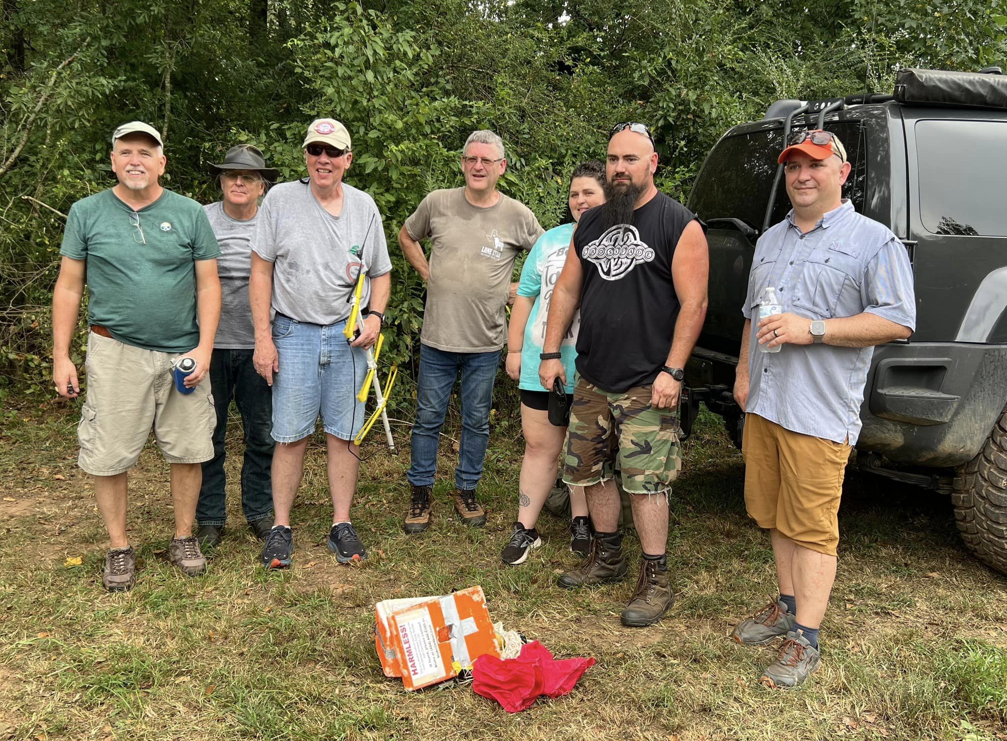
went up at 10:00 a.m.) it was agreed that the triangulation of signals was pointing to the same place. All teams began to converge. It was at this point that providence smiled upon us. For some unknown reason, the GPS came back to life long enough to send out two transmissions, each containing the payloads coordinates. We had it surrounded and now knew exactly where it was. Joshua Benefield KF4DVW, and Richard Hilling KN4FRP braved the brush to retrieve the package. Joshua emerged triumphant with the payload so we can fly another day.
So, what’s the point of all of this you ask? Number one is it is a whole lot of fun. However, there is a much more important point of this kind of activity. While it is a great deal of fun, it also tests the skills of local hobbyists in tracking down any type of beacon that may be carried by a lost hiker, private plane, malicious interference to public service, etc as well as the exercise of the pure science and mathematics involved in making it happen.
If you or someone you know may be interested in participating in such an exercise, please contact us at the West Georgia Amateur Radio Society at This email address is being protected from spambots. You need JavaScript enabled to view it. or P.O. Box 102 Bowdon Junction, GA 30109. To participate in these activities you do not have to be a licensed amateur. We also have a website at http://www.wgars.com and a facebook site – www.facebook.com/wgars.